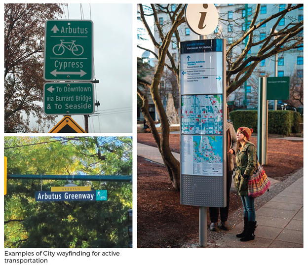
Development of a Wayfinding Strategy for Arbutus Greenway celebrates its role as a vibrant and beautiful public place for walking, wheeling and cycling.
Activate Planning and GJD Planning + Design were engaged to develop a wayfinding strategy, including guidelines for signage and placement of wayfinding information along the Arbutus Greenway. The project will ensure that the route is easily navigable as part of the City’s All Ages and Abilities active transportation network and includes placemaking and interpretation in activating the Greenway.
Our team examined the history of the route, existing signage, wayfinding information available in print and online and conventions and standards within provincial, regional and local guidance, as well as wayfinding on other active transportation routes locally and internationally as inspiration. The resulting Strategy situates the route within its long history of use as an indigenous trail and more recently as a rail line, and within the expanding local and regional active transportation networks. The Strategy has a role in encouraging appropriate use, offers legibility treatments to highlight priority for pathway users and elevates the corridor in people’s mental minds by recommending distinctive crossing treatments, distance markers, maps and signage that animate the route.